
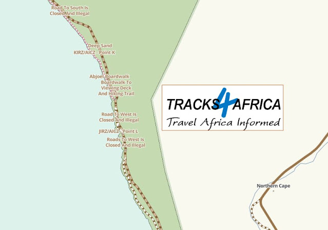
View possible routes on Google Maps. Use Tracks4Africa to do the route.
The route allows you to experience a wide range of Namaqua habitats, from mountains to coast. The route starts at the world famous Skilpad Wildflower Reserve– now part of the Namaqua National Park-, where the parks’ offices are situated. The road then descents down the Soebatsfontein pass, before turning north to the Wildeperdehoek grass plains. An interesting detour is possible to include the Wildeperdehoek pass. From here the road goes through the Namaqua flatlands. This area is renowned for its ‘Riethuis quartz’ and the dune areas, which has a dry fynbos type growing here. Crossing the main Hondeklip bay road you will enter the Namakwa Coastal section of the park, which consists of 50km spectacular coastline, before ending at Groen river mouth.
This is an easy to moderate, with occasional sandy sections along the coast. Some sections are steep with dongas and a 4x4 vehicle is essential.
The distances range from 176km - 200km, depending on which tracks you select. The route can either be done in sections or completely. Allow yourself a few days here to do it properly.
You can also extend your tour southwards on the Westcoast Trail (Groenrivier to Elandsbaai).
Website: https://www.sanparks.org/parks/namaqua/tourism/caracal_eco_route.php & https://www.trailforks.com/route/caracal-eco-route-namaqua-national-park/ Tel: (027) 672 1948, Elanza van Lente: Elanza.vanlente@sanparks.org
Website: https://www.sanparks.org/parks/namaqua/tourism/caracal_eco_route.php & https://www.trailforks.com/route/caracal-eco-route-namaqua-national-park/ Tel: (027) 672 1948, Elanza van Lente: Elanza.vanlente@sanparks.org
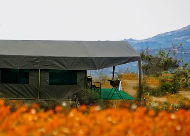
Typical Coastal Campsites. They are all listed under the category "Namaqua NP"

Start of coastal Section and Spoegrivier Caves.

The Spoegrivier Caves are of archaeological importance as they contain the earliest evidence of sheep in South Africa. The bones found date back about 2 000 years. The National Monuments Act protects this site therefore no camping, fires, digging or vehicles are permitted in the caves.

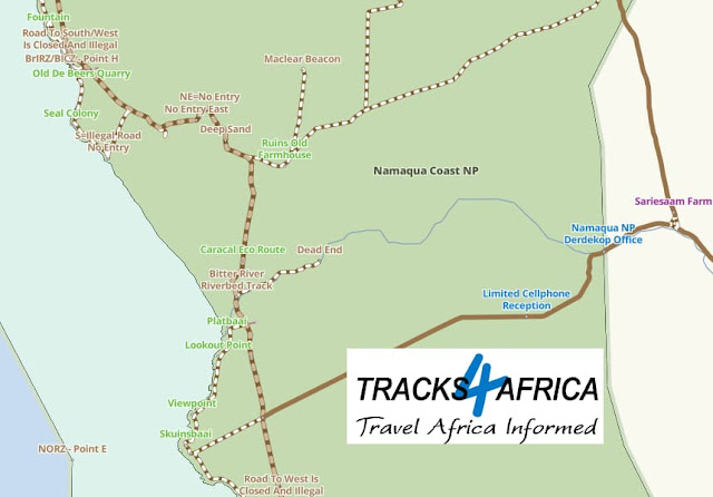


Wildeperdehoek pass. This pass could be included if you want on your trip. It is not part of the standard trail.

Other passes in the region, but not part of this trail are:
Messelpad Pass. Not suitable for sedan vehicles. High ground clearance is needed. It is about 16km in lenght.
Killians Pass. It is a reasonable safe drive, although it is steep in some places.
Grootvlei Pass. It is just a bit east of Killians Pass and is about 4km long. It does have some steep sections.

There are no set way to do these routes, as there are many ways in which they can be combined with other interesting places in the area to be explored.
__________________

____________________